FireFinder is a real-time wildfire detector and monitoring platform that helps prevent and control wildfires effectively.
AI Business Ideas Generator
#wildfire detection
#real-time monitoring
#satellite technology
#AI for wildfire
#fire management solutions
#environmental safety
#community preparedness
#fire department tools
#emergency response
#forest fire prevention
#data analysis for wildfires
#hazard detection
#ecological monitoring
#disaster response
#risk assessment
#fire alert system
#sustainable practices
#community engagement
#environmental protection
...
Promote this Tool
Update this Tool

Firefinder
FireFinder is a real-time wildfire detector and monitoring platform that helps prevent and control wildfires effectively.
AI Business Ideas Generator
#wildfire detection
#real-time monitoring
#satellite technology
#AI for wildfire
#fire management solutions
#environmental safety
#community preparedness
#fire department tools
#emergency response
#forest fire prevention
#data analysis for wildfires
#hazard detection
#ecological monitoring
#disaster response
#risk assessment
#fire alert system
#sustainable practices
#community engagement
#environmental protection
...

Featured
 ThumbnailCreator.comAI-powered tool for creating stunning, professional YouTube thumbnails quickly and easily.
- Video Watermark RemoverAI Video Watermark Remover – Clean Sora 2 & Any Video Watermarks!
- AdsCreator.comGenerate polished, on‑brand ad creatives from any website URL instantly for Meta, Google, and Stories.
- Refly.aiRefly.AI empowers non-technical creators to automate workflows using natural language and a visual canvas.
- Elser AIAll-in-one AI video creation studio that turns any text and images into full videos up to 30 minutes.
- BGRemoverEasily remove image backgrounds online with SharkFoto BGRemover.
- VoxDeckNext-gen AI presentation maker,Turn your ideas & docs into attention-grabbing slides with AI.
- FineVoiceClone, Design, and Create Expressive AI Voices in Seconds, with Perfect Sound Effects and Music.
- QoderQoder is an agentic coding platform for real software, Free to use the best model in preview.
- FixArt AIFixArt AI offers free, unrestricted AI tools for image and video generation without sign-up.
- FlowithFlowith is a canvas-based agentic workspace which offers free 🍌Nano Banana Pro and other effective models...
- Skywork.aiSkywork AI is an innovative tool to enhance productivity using AI.
- SharkFotoSharkFoto is an all-in-one AI-powered platform for creating and editing videos, images, and music efficiently.
- PippitElevate your content creation with Pippit's powerful AI tools!
- Funy AIAI bikini & kiss videos from images or text. Try the AI Clothes Changer & Image Generator!
- KiloClawHosted OpenClaw agent: one-click deploy, 500+ models, secure infrastructure, and automated agent management for teams and developers.
- Yollo AIChat & create with your AI companion. Image to Video, AI Image Generator.
- SuperMaker AI Video GeneratorCreate stunning videos, music, and images effortlessly with SuperMaker.
- AI Clothes Changer by SharkFotoAI Clothes Changer by SharkFoto instantly lets you virtually try on outfits with realistic fit, texture, and lighting.
- AnimeShortsCreate stunning anime shorts effortlessly with cutting-edge AI technology.
- InstantChaptersCreate Youtube Chapters with one click and increase watch time and video SEO thanks to keyword optimized timestamps.
- wan 2.7-imageA controllable AI image generator for precise faces, palettes, text, and visual continuity.
- AI Video API: Seedance 2.0 HereUnified AI video API offering top-generation models through one key at lower cost.
- WhatsApp AI SalesWABot is a WhatsApp AI sales copilot that delivers real-time scripts, translations, and intent detection.
- insmelo AI Music GeneratorAI-driven music generator that turns prompts, lyrics, or uploads into polished, royalty-free songs in about a minute.
- KirkifyKirkify AI instantly creates viral face swap memes with signature neon-glitch aesthetics for meme creators.
- BeatMVWeb-based AI platform that turns songs into cinematic music videos and creates music with AI.
- UNI-1 AIUNI-1 is a unified image generation model combining visual reasoning with high-fidelity image synthesis.
- Wan 2.7Professional-grade AI video model with precise motion control and multi-view consistency.
- Text to MusicTurn text or lyrics into full, studio-quality songs with AI-generated vocals, instruments, and multi-track exports.
- Iara ChatIara Chat: An AI-powered productivity and communication assistant.
- kinovi - Seedance 2.0 - Real Man AI VideoFree AI video generator with realistic human output, no watermark, and full commercial use rights.
- Video Sora 2Sora 2 AI turns text or images into short, physics-accurate social and eCommerce videos in minutes.
- Tome AI PPTAI-powered presentation maker that generates, beautifies, and exports professional slide decks in minutes.
- Lyria3 AIAI music generator that creates high-fidelity, fully produced songs from text prompts, lyrics, and styles instantly.
- AtomsAI-driven platform that builds full‑stack apps and websites in minutes using multi‑agent automation, no coding required.
- AI Pet Video GeneratorCreate viral, shareable pet videos from photos using AI-driven templates and instant HD exports for social platforms.
- Paper BananaAI-powered tool to convert academic text into publication-ready methodological diagrams and precise statistical plots instantly.
- Ampere.SHFree managed OpenClaw hosting. Deploy AI agents in 60 seconds with $500 Claude credits.
- Hitem3DHitem3D converts a single image into high-resolution, production-ready 3D models using AI.
- Palix AIAll-in-one AI platform for creators to generate images, videos, and music with unified credits.
- HookTideAI-powered LinkedIn growth platform that learns your voice to create content, engage, and analyze performance.
- GenPPT.AIAI-driven PPT maker that creates, beautifies, and exports professional PowerPoint presentations with speaker notes and charts in minutes.
- Create WhatsApp LinkFree WhatsApp link and QR generator with analytics, branded links, routing, and multi-agent chat features.
- Seedance 20 VideoSeedance 2 is a multimodal AI video generator delivering consistent characters, multi-shot storytelling, and native audio at 2K.
- GobiiGobii lets teams create 24/7 autonomous digital workers to automate web research and routine tasks.
- Veemo - AI Video GeneratorVeemo AI is an all-in-one platform that quickly generates high-quality videos and images from text or images.
- Free AI Video Maker & GeneratorFree AI Video Maker & Generator – Unlimited, No Sign-Up
- ainanobanana2Nano Banana 2 generates pro-quality 4K images in 4–6 seconds with precise text rendering and subject consistency.
- GLM ImageGLM Image combines hybrid AR and diffusion models to generate high-fidelity AI images with exceptional text rendering.
- AI FIRSTConversational AI assistant automating research, browser tasks, web scraping, and file management through natural language.
- WhatsApp Warmup ToolAI-powered WhatsApp warmup tool automates bulk messaging while preventing account bans.
- AirMusicAirMusic.ai generates high-quality AI music tracks from text prompts with style, mood customization, and stems export.
- Manga Translator AIAI Manga Translator instantly translates manga images into multiple languages online.
- TextToHumanFree AI humanizer that instantly rewrites AI text into natural, human-like writing. No signup required.
- Remy - Newsletter SummarizerRemy automates newsletter management by summarizing emails into digestible insights.
- Telegram Group BotTGDesk is an all-in-one Telegram Group Bot to capture leads, boost engagement, and grow communities.
- FalcoCutFalcoCut: web-based AI platform for video translation, avatar videos, voice cloning, face-swap and short video generation.
ThumbnailCreator.com
AI-powered tool for creating stunning, professional YouTube thumbnails quickly and easily.
Video Watermark Remover
AI Video Watermark Remover – Clean Sora 2 & Any Video Watermarks!
AdsCreator.com
Generate polished, on‑brand ad creatives from any website URL instantly for Meta, Google, and Stories.
Refly.ai
Refly.AI empowers non-technical creators to automate workflows using natural language and a visual canvas.
Elser AI
All-in-one AI video creation studio that turns any text and images into full videos up to 30 minutes.
BGRemover
Easily remove image backgrounds online with SharkFoto BGRemover.
VoxDeck
Next-gen AI presentation maker,Turn your ideas & docs into attention-grabbing slides with AI.
FineVoice
Clone, Design, and Create Expressive AI Voices in Seconds, with Perfect Sound Effects and Music.
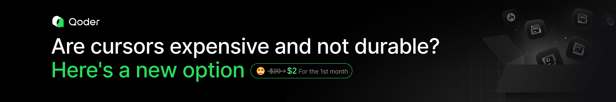
Qoder
Qoder is an agentic coding platform for real software, Free to use the best model in preview.
FixArt AI
FixArt AI offers free, unrestricted AI tools for image and video generation without sign-up.
Flowith
Flowith is a canvas-based agentic workspace which offers free 🍌Nano Banana Pro and other effective models...
Skywork.ai
Skywork AI is an innovative tool to enhance productivity using AI.
SharkFoto
SharkFoto is an all-in-one AI-powered platform for creating and editing videos, images, and music efficiently.
Pippit
Elevate your content creation with Pippit's powerful AI tools!
Funy AI
AI bikini & kiss videos from images or text. Try the AI Clothes Changer & Image Generator!
KiloClaw
Hosted OpenClaw agent: one-click deploy, 500+ models, secure infrastructure, and automated agent management for teams and developers.
Yollo AI
Chat & create with your AI companion. Image to Video, AI Image Generator.
SuperMaker AI Video Generator
Create stunning videos, music, and images effortlessly with SuperMaker.
AI Clothes Changer by SharkFoto
AI Clothes Changer by SharkFoto instantly lets you virtually try on outfits with realistic fit, texture, and lighting.
AnimeShorts
Create stunning anime shorts effortlessly with cutting-edge AI technology.
InstantChapters
Create Youtube Chapters with one click and increase watch time and video SEO thanks to keyword optimized timestamps.
wan 2.7-image
A controllable AI image generator for precise faces, palettes, text, and visual continuity.
AI Video API: Seedance 2.0 Here
Unified AI video API offering top-generation models through one key at lower cost.
WhatsApp AI Sales
WABot is a WhatsApp AI sales copilot that delivers real-time scripts, translations, and intent detection.
insmelo AI Music Generator
AI-driven music generator that turns prompts, lyrics, or uploads into polished, royalty-free songs in about a minute.
Kirkify
Kirkify AI instantly creates viral face swap memes with signature neon-glitch aesthetics for meme creators.
BeatMV
Web-based AI platform that turns songs into cinematic music videos and creates music with AI.
UNI-1 AI
UNI-1 is a unified image generation model combining visual reasoning with high-fidelity image synthesis.
Wan 2.7
Professional-grade AI video model with precise motion control and multi-view consistency.
Text to Music
Turn text or lyrics into full, studio-quality songs with AI-generated vocals, instruments, and multi-track exports.
Iara Chat
Iara Chat: An AI-powered productivity and communication assistant.
kinovi - Seedance 2.0 - Real Man AI Video
Free AI video generator with realistic human output, no watermark, and full commercial use rights.
Video Sora 2
Sora 2 AI turns text or images into short, physics-accurate social and eCommerce videos in minutes.
Tome AI PPT
AI-powered presentation maker that generates, beautifies, and exports professional slide decks in minutes.
Lyria3 AI
AI music generator that creates high-fidelity, fully produced songs from text prompts, lyrics, and styles instantly.
Atoms
AI-driven platform that builds full‑stack apps and websites in minutes using multi‑agent automation, no coding required.
AI Pet Video Generator
Create viral, shareable pet videos from photos using AI-driven templates and instant HD exports for social platforms.
Paper Banana
AI-powered tool to convert academic text into publication-ready methodological diagrams and precise statistical plots instantly.
Ampere.SH
Free managed OpenClaw hosting. Deploy AI agents in 60 seconds with $500 Claude credits.
Hitem3D
Hitem3D converts a single image into high-resolution, production-ready 3D models using AI.
Palix AI
All-in-one AI platform for creators to generate images, videos, and music with unified credits.
HookTide
AI-powered LinkedIn growth platform that learns your voice to create content, engage, and analyze performance.
GenPPT.AI
AI-driven PPT maker that creates, beautifies, and exports professional PowerPoint presentations with speaker notes and charts in minutes.
Create WhatsApp Link
Free WhatsApp link and QR generator with analytics, branded links, routing, and multi-agent chat features.
Seedance 20 Video
Seedance 2 is a multimodal AI video generator delivering consistent characters, multi-shot storytelling, and native audio at 2K.
Gobii
Gobii lets teams create 24/7 autonomous digital workers to automate web research and routine tasks.
Veemo - AI Video Generator
Veemo AI is an all-in-one platform that quickly generates high-quality videos and images from text or images.
Free AI Video Maker & Generator
Free AI Video Maker & Generator – Unlimited, No Sign-Up
ainanobanana2
Nano Banana 2 generates pro-quality 4K images in 4–6 seconds with precise text rendering and subject consistency.
GLM Image
GLM Image combines hybrid AR and diffusion models to generate high-fidelity AI images with exceptional text rendering.
AI FIRST
Conversational AI assistant automating research, browser tasks, web scraping, and file management through natural language.
WhatsApp Warmup Tool
AI-powered WhatsApp warmup tool automates bulk messaging while preventing account bans.
AirMusic
AirMusic.ai generates high-quality AI music tracks from text prompts with style, mood customization, and stems export.
Manga Translator AI
AI Manga Translator instantly translates manga images into multiple languages online.
TextToHuman
Free AI humanizer that instantly rewrites AI text into natural, human-like writing. No signup required.
Remy - Newsletter Summarizer
Remy automates newsletter management by summarizing emails into digestible insights.
Telegram Group Bot
TGDesk is an all-in-one Telegram Group Bot to capture leads, boost engagement, and grow communities.
FalcoCut
FalcoCut: web-based AI platform for video translation, avatar videos, voice cloning, face-swap and short video generation.
What is Firefinder?
FireFinder is an advanced platform that provides real-time wildfire detection and monitoring. By leveraging satellite data and AI technology, it enables timely identification of wildfire outbreaks, thus aiding in swift and accurate responses. FireFinder is designed for various stakeholders, including fire departments, environmental agencies, and local communities, offering them a reliable solution for wildfire prevention, mitigation, and control.
Who will use Firefinder?
- Fire departments
- Environmental agencies
- Local communities
- Government agencies
- Emergency response teams
How to use the Firefinder?
- Step1: Sign up for an account on FireFinder.
- Step2: Log in to the platform.
- Step3: Access the real-time wildfire map.
- Step4: Customize alert settings based on your location and preferences.
- Step5: Receive notifications and updates on wildfire activity.
- Step6: Take necessary preventive or responsive actions based on the alerts.
Platform
- web
- ios
- android
Firefinder's Core Features & Benefits
The Core Features
- Real-time wildfire detection
- Satellite data integration
- AI-powered analysis
- Customizable alert settings
- User-friendly interface
The Benefits
- Early detection of wildfires
- Enhanced response time
- Reduced damage and loss
- Improved situational awareness
- Supports preventive measures
Firefinder's Main Use Cases & Applications
- Monitoring wildfires in real-time
- Receiving alerts for potential wildfire threats
- Accessing historical wildfire data for analysis
FAQs of Firefinder
Firefinder Company Information
- FireFinder
Firefinder Reviews
5/5
Firefinder's Main Competitors and alternatives?
- Firewatch
- RedZone
- Firescope
- Wildfire Analyst
You may also like:
Create comprehensive sales battlecards instantly with Ignition's free template generator.
Elevate your business efficiency with 200+ tailored AI prompts.
Generate web applications instantly using AI-driven prompts with UI Bakery's AI App Generator.
AI-powered tool for content creators to generate trending social media ideas effortlessly.
AI-powered tool for creating stunning, professional YouTube thumbnails quickly and easily.
AD
Discover 1000+ AI-powered side hustle ideas tailored to your skills and preferences.
Empower businesses with AI-based solutions for chatbot deployment and lead generation.
AI-powered platform to help aspiring entrepreneurs plan and launch their businesses.